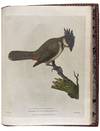
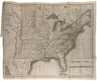
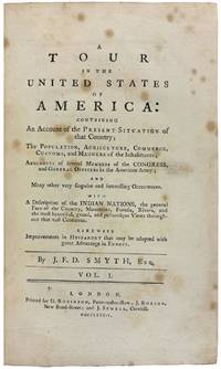
London: Published by George Goulding, Haydn's Head, No. 6, James Street, Covent Garden, 1789. Large 4to. (11 1/2 x 9 inches). First edition. [a]-d4 A-Yy4 A-F4. [i]-xxix [3] [1]-360 [1]-47 [1]. 440 pp. 22 engraved maps, charts, plates, and views after G. Dixon, J. Hogan, William Lewin, Collings, and others, by Barlow, P. Mazell, J. Reid, E. F. Burney, and others, including 7 hand-colored natural history plates; 7 folding maps and views; 1 plate of sheet music; 1 folding plate; and 6 others. Half-title, Title, Dedication to Joseph Banks, Introduction, Contents, Errata, Binder directions, Letters I-XLIX, Appendices I-II, Tables I-XIII. Contemporary full
(truncated) calf rebacked, spine lettered and ruled gilt, neat repairs to corners
A Deluxe hand-coloured first edition on large and thick paper of this important account of an early exploratory voyage to Hawaii and the Pacific Northwest. "An excellent authority for the early days of fur trading on the northwest coast." [Streeter]
"Dixon's voyage is important as a supplement to Captain Cook and for its contribution to the natural history of the Pacific Northwest. The purpose of the expedition was to establish a trade in furs in North America, but the itinerary also includes the Isle of Guernsey, Cape Verde Islands, Falkland Islands, Cape Horn, Sandwich Islands (three times), Cook's River, King George's Sound, Prince William Sound, Macao, Canton, and St. Helena. The voyage was sent out by the King George's Sound Company, which owned both the King George, commanded by expedition leader Captain Nathaniel Portlock, as well as the Queen Charlotte. The two ships sailed independently of each other for part of the expedition. Both Portlock and Dixon had served on Cook's third voyage. The work previously done by Cook along the northwest coast of America was mapped more definitely by Dixon, who discovered the Queen Charlotte Islands, Port Mulgrave, Norfolk Bay, and Dixon Entrance and Archipelago, while continuing down the coast and trading with the Indians. The accounts of this expedition relate largely to the geography, ethnology, and natural history of the American coast from Nootka Sound northward." [Hill] The bulk of the text is in the form of a series of forty-nine letters from Beresford, who was aboard the Queen Charlotte, but is supplemented by tables and observations from Dixon himself, who also edited and corrected the whole work. Dixon was directly responsible for a number of the maps, charts, and plates which are engraved after his original drawings. The regular issue, published at 1£.1s, contains no hand-colored plates and is less than ten and a half inches in height; but a small number of copies were printed on larger, thicker paper with the natural history plates hand-colored, as in the exceptional present copy.
Bell B204. Buck 35. ESTC T82170. Forbes 161. Hill 118 (2004). Howes D365. JCB II, 3270. Judd 53. Lada-Mocarski 43. Lande 960. Nissen ZBI 1120. Pilling, Proof-Sheets 1042. Reese, Best of the West 16. Sabin 20364, 64390. Smith 779. Story, p. 217. Strathern and Edwards 37. Streeter Sale 3484. TPL 593. Wagner I, 207; II, 732-735. Wickersham 6574.
(Inventory #: 42020)


