1827 · Brussels
by VANDERMAELEN, Philippe Marie
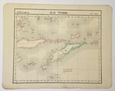
Brussels: Philippe Marie Vandermaelen, 1827. Map. Hand colored engraving. Image measures 18 1/2" x 22"
Beautiful and simple map of the island of Timor and surrounding islands. From Vandermaelen's 6 volume "Atlas universel de geographie physique, politique, statistique et mineralogique, sur l'echelle...". Can be combined as gores to form an immense globe.
Phillippe Marie Vandermaelen (1795-1869) was a Belgian cartographer and publisher. His Atlas universal was both the first lithograph atlas and the first atlas to map the world on a uniform scale. The maps were meant to join together to form a huge globe. (Inventory #: 325002)


