NA
1874 · Boston
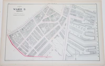
Boston: G. M. Hopkins, 1874. NA. Lightly hand-colored 1874 of a large part of the Second Ward in Boston, which is in the North End of Boston, the oldest part of the city, now an integral part of Boston's Little Italy, which centers on North Square, present on this map. The ward map includes a strip of the Harbor, with a number of wharves, and some of the principal streets are Atlantic Avenue, Commercial Street, North Street, Hanover Street. A wonderful feature of the map is that it identifies the owners and/or businesses of each of the buildings or lots. The map measures 44 by 67 cm. It is scaled 100 feet to the inch. Folded vertically down the middle, (truncated)


