NA
1874 · Boston
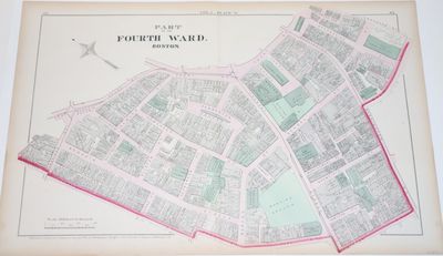
Boston: G. M. Hopkins, 1874. NA. Hand-colored 1874 of a chunk of the Fourth Ward in Boston, which is in Downtown Boston and includes Tremont Street, Washington Street, Court Street, Park Street, etc. The map today has significant differences with the street lay-out, as, for instance, Pemberton Square, which is near the center of the map, is no more. Particularly appealing about the map is that it identifies the owners and/or businesses of each of the buildings or lots. The map measures 44 by 67 cm. It is scaled 100 feet to the inch. Folded vertically down the middle, it obviously was pulled out of a large ward atlas. Still, it works well as a standalone (truncated)


